Friday, October 29, 2010

Georgia, To Conquer A Dragon


Arriving at Atlanta Hartsfield Airport, I am about to take a step back in time. Equipped with just a backpack, Samsung SL605 point and shoot camera and a helmet, I am about to become a dragon slayer.


MARTA Train I will need some assistance to complete my mission so I pay a $4.50 fare and board MARTA, the Atlanta transit system.

I am headed to see the dragon slayer master who will meet me at the Lindbergh station.


SAM 004 About an hour after arriving in Atlanta, I am at Dan's Motorcycle where I suit up and take command of a dark blue Honda ST-1300.

Dan provides some local information then escorts us to the Georgia 400. A wave off at 70 miles per hour and we are now alone on our way to meet a dragon.


SAM 007 Georgia 400


Along some areas of the highway, the median is covered with brilliant pink and purple flowers which provide a stark contrast to the bright reds, orange and yellows in the background.


SAM 010 I am soon beginning to sense the dragon's far reaching powers as the surrounding scenery soon becomes captivating and requires an inner strength to press on to my destination.

I am told the further north I travel the more engaging the scenery will become.

I have no doubts.


SAM 013 Today, traffic flows well along what has now become 19/60 North.

Weakened by the gorgeous landscape and feeling the need to stand and stretch, we make a stop at a Georgia institution, Chick Fil A.


While dining on a Spicy Chicken Sandwich along with a Polynesian Sauce, Diet Lemonade and Waffle fries, I encounter a Merlin who gives me more insight for my journey. With a magic touch he fires up his electronic information capsule and together we go over a heavenly view map of the area courtesy of the Google gods.


SAM_3770Dragon Slayer?


Calculating the time of the falling sun, we are given cautious warnings of the north wind and falling temperatures as our journey will now take us to higher elevations.


SAM_3772 With a blessing from the “Great Wizard” we are soon snaking our way on 60 North toward Suches, Georgia.

The temptation to stop and be engulfed by spectacular scenery is becoming more and more irresistible even as I race against a westward sun.


SAM 014 A sparkling blue lake accented with fall foliage against a perfectly clear blue sky and my ST-1300 comes to a complete stop.


SAM 021This is a view that must be enjoyed at zero miles per hour.


SAM 022 A calm lake surrounded by beautiful fall foliage.


SAM 017 Continuing the journey, we begin to ride the back of a snake as it slivers it’s way through a mountain landscape that is as peaceful as it is beautiful.


SAM 016 Sneaking between tall trees the sun becomes a lighting technician on a movie set, highlighting some areas and shading others.


SAM 018 Setting the right mood and spotlighting the right colors to enjoy nature's fall foliage.


SAM 025


SAM 028 Open areas along the highway show wide  farmlands and a chance to feel the sun’s warmth against the autumn temperatures that are starting to fall.


SAM 020 Passing through Ducktown, Tennessee, we now join Tennessee 68 North. It is not long before the views are displaying more curves and brilliant colors.


As previously warned, the north wind is beginning to make it's presence felt. Somewhere along 68 North another temptation crosses my path in the form of a Kawasaki Voyager.


Kawasaki Voyager For $1500 cash this requires further investigation and serious consideration.


We have lost the battle with the westward sun as we make a fuel stop at Tellico Plains, Tennessee but I am within striking distance of the dragon. Only about 50 miles and one mountain pass separates us.


SAM_3608 As the moon climbs higher in the night sky and a cold wind crosses my face, I take on the last challenge before I become a Conqueror or conquered.


Tuesday, October 19, 2010

New Hampshire, Kancamagus Highway


CAN 473 Joining the Kancamagus Highway the sun is beginning to say a colorful good-bye to the day.


CAN 492 It's soft orange farewell adds to the surrounding fall foliage and gives it a warm feeling despite the chill developing in the air.


CAN 475


Headed to Conway, New Hampshire from I-93, the town of Lincoln provides the best opportunity for dining as the next 34 miles will only fill your scenic appetite. Hoping to spot moose dining along the highway, I discard my hunger and press on.


CAN 494 My first scenic spot rewards me with the rushing sounds of the Pemigewasset River and the fall colors along it's banks.


CAN 495 I also get the chance to meet one heck of a cute Chinese kid traveling with his parents.

Carrying a picture of a 747, I take a quick liking to this kid.


CAN 505 Kancamagus Highway


With tall trees on either side of the highway blocking the setting sun, in some areas it seems as if I am driving in and out of the edge darkness. Where the sun breaks thru it enriches the already bright red and warm orange leaves.


CAN 503 Pemigewasset River


This evening I am guessing all the moose are seniors and have opted for the early dinner specials. I have been told the grassy areas along the river bank and highway is where they are normally spotted in the early morning or evening hours. In Lincoln there are “Moose Tours” that guarantee sightings but I imagine this is in areas away from the highway.


CAN 512 Despite the lack of moose sightings the scenery along the Kancamagus Highway is still worth the drive.

The Kancamagus Highway is open year round and offers lots of outdoor activities.


Arriving at the other end of the Kancamagus Highway in Conway, although it is dark I am in search of a famous New England covered bridge. Stopping at a local gas station for information I am approached by a young kid and asked...

“Do you know anyone going to Albany? I have just been punched in the stomach and need a ride home.”

We are both in a predicament and work out a nice compromise. He will show me a nearby covered bridge and I will give him a ride home. I am not one to pick up hitch hikers even if they are just 11 years old but I sense this kid is not a mass murderer. He turns out to be funny, quick witted and a good storyteller as he quizzes me and becomes an on the spot tour guide.


CAN 521 Not far from my original stop we are crossing the Saco River and a covered bridge built in 1890.


SAM 018 “If you look down there, you can see the river. I go swimming there and last week my friends found a dead shark in it”

Maybe just another fish story but told by an 11 year old, it's believable.


Fulfilling my end of the deal, I am navigating off the beaten path but minutes later I am dropping a polite and appreciative kid home.


SAM 010 Now traveling south on Highway 16 it's time to feed my hunger.

A stop at Sammy's and I am enjoying a sandwich and a hot tea to warm my bones.


SAM 003 Chicken Pesto, Homemade Potato Chips


My sandwich on focaccia is a little heavy on the bread but it is not bad for a joint named after a cute dog.


Monday, October 18, 2010

Washington, Mount St. Helens


Map picture

“Vancouver!, Vancouver!, This Is It!”

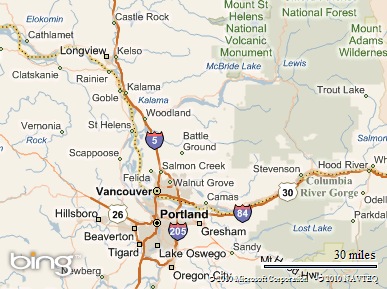
From downtown Portland, Oregon I exit from Interstate 5 North onto Highway 504E. I am on my way to the Johnston Ridge Observatory at Mount St. Helens.


CAN 155 It is a scenic drive along Highway 504 with glimpses of Mount St. Helen's always in the distance on this clear and beautiful day.


CAN 234 Fall is in the air and this seems as nice a time as ever to relive a momentous piece of history.


CAN 271


CAN 186 From desolate hillsides to a Ford Granada covered in a black soot my route to Mount St. Helens is still filled with reminders of what happened on that morning over thirty years ago.


CAN 231 Passing gorgeous mountain scenery, I arrive at Johnston Ridge Observatory about 42 seconds before the next movie presentation of the May 1980 events is about to begin.


A $8 admission fee that supports the park and allows usage at nearby trails and lakes is a worthwhile investment.


CAN 245 Coldwater Lake


CAN 275 Although the movie is 1980's low tech, it is a powerful reminder of nature's awesome power.

Months prior to Mount St. Helens eruption scientists had been monitoring a huge growth on the mountain.


CAN 302 It seems the lady was putting on a little weight at a rate that so surprised the scientists that at one point they sent their equipment back to be re-calibrated.

At a growth rate of 5 feet per day, the equivalent of a human gaining 200 pounds per day in “doggie years”, this was astounding!


It is said that on May 18th, 1980, Mount St. Helen lost the “Battle of The Bulge”. Unfortunately, David A. Johnston a geologist working on his day off for a colleague witnessed this defeat but lost his life in the process.


CAN 256 The eruption of Mount St. Helens is the largest ever recorded landslide.


Half of the mountain fell that day spreading it's contents in all directions with up to 180 miles per hour winds preceding it. The “Blast Zone” from this extended up to 14 miles in some directions leaving a path of destruction behind.


CAN 556 Imagine an uprooted 100 feet tall over 15 inch diameter tree hurling towards you at 180 miles per hour.

This force knocked out bridges, destroyed an entire landscape, buried a river with up to 600 feet of debris and even created new lakes.


As the movie ends the stage curtains rise and we get a view of Mount St. Helen while still seated in the auditorium, a nice touch to the presentation.

Inside the observatory informative exhibits and first hand accounts from those that experienced the eruption and effects of Mount St. Helens on May 18th, 1980. Heroic stories and amazing photographs.


CAN 281 Ever thought you were a heavy weight?

Well, here you can get a chance to measure up. Activating a seismograph on display, I am proud to say I measure a warping 0.0000000001 on the Richter scale.

I bet you are impressed.


CAN 283

Press a button at the observatory main display and you can relive St. Helen's eruption in a colorful light display.


CAN 282 The Blast Zone


Outside, I join up with a few other park visitors for the last Park Ranger talk of the day at 5:15pm. We appreciate the humor and presentation as we learn a little more about life and the events in the area before and after the eruption. It is amazing to learn that since the eruption, frogs, snakes, rats and even elk have been found living in the crater since 1980.


Mount St Helen Crater Today, one of the youngest glaciers in the world is also forming inside the crater wall.


Mount St Helen Elk At one point it was believed that another major eruption was imminent.

However, on further investigation it was discovered that it was just an elk doing some butt scratching on the equipment in the crater that was giving unusually high seismographic readings.


From the 1980 eruption at Mount St. Helen scientists have learned so much about our ever changing world and what goes on beneath the surface of it. This knowledge is being made useful to predict and provide warnings of other possible eruptions worldwide.

At Mount St. Helens, nature has been on it's best behavior since 1980 with only a few minor exceptions. Although we know of it's destructiveness, today I am fortunate to observe a part of it's spectacular beauty.


 SAM 006 Awesome!


Sunday, October 17, 2010

Washington, Back To The 80's


Map picture


The Columbia River separates me from my destination but it is easily crossed from downtown Portland, Oregon. I am on Interstate 5 headed north.


SAM 002 It takes about one hour before I exit Highway 504E.

The Johnston Ridge Observatory is now just 52 miles away along a promising scenic route.


CAN 163 Today, the weather is nice with clear skies and temperatures in the 60's.


CAN 165

Isolated yellows standout against bright evergreens.

A gentle reminder of the approaching winter as the sweet smell of fresh pine permeates the air.


CAN 234 Further along touches of reds and orange add to the reminder.


Ascending Highway 504 glimpses of my destination can be seen in the distance. In some ways I am not in a hurry to get there, the journey is becoming almost as fascinating as the destination.


CAN 173 The Toutle River changes sides along Highway 504 like a major league switch hitter.

In the shadow of the afternoon sun, at the right spots it delivers nicely to the landscape.


At one point in the 1980's this river was in some areas buried up to 600 feet deep in debris. Today it's waters flow clear and free, a relaxing sound.


CAN 184 A Nice Slightly Used Ford Granada


At Hoffstadt Bluffs Visitor Center my destination draws closer and a reminder of it's history is on display. A reporter's car from a local television station, KOMO 4 News still shows evidence of what happened on that fateful day over 30 years ago.


CAN 189 A quick glimpse from the Visitor Center's lookout points but it is too early in the day to spot local elk that feed in the valley below.

The fresh air and clear skies makes returning to the car a bit disappointing. These are the days made for a convertible.


CAN 194 At another of many stops this time I am at the edge of the blast zone.

It is almost unimaginable to revisit the destruction that was here.

A new bridge easily masses what was although nature still has some of it’s foot prints left behind.


CAN 252  Fields Of Destruction


CAN 201 Today, however through careful forest management, good portions of the area are seeing signs of a vital rebirth.


SAM 004 My exit approaches and I make a stop at Coldwater Lake.


CAN 230 I am now less than 10 miles from taking a step back in history. A history that formed this lake.


Parking my car at Loowit Viewpoint, I have an informative conversation with a local volunteer doing some maintenance work around the parking lot. I receive a nice history lesson of the area and have my curious questions answered.


SAM 006 A short walk along Boundary Trail and I will arrive at my destination.


CAN 268 Some life has recovered nicely along the Boundary Trail even as I still witness a historical dying field.


CAN 269 Destroyed Ridge


CAN 300 I have arrived at the Johnston Ridge Observatory across the valley from Mount St. Helens.

“Vancouver!, Vancouver! This is it!”


This observatory is named in honor of David A. Johnston a geologist and the first to report Mount St. Helen's eruption before being swept away by the lateral blast it created on a Sunday morning, May 18th, 1980.